Latest road status, weather, opening timings, distance chart & everything you need to know.
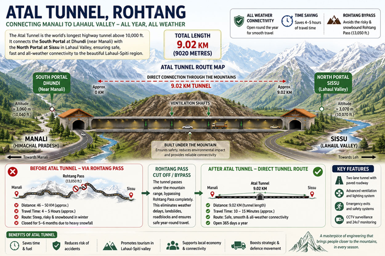
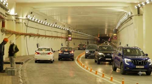
Atal Tunnel (Rohtang Tunnel) is the world's longest highway tunnel above 10,000 feet. It connects Manali to Lahaul-Spiti, reducing travel time by 4–5 hours.
Click on the map below to open it in a large, high-resolution window. The route from Manali to Sissu via the tunnel is clearly marked.
First proposed in 2000 to ensure all-weather connectivity.
Cabinet approved in 2010, foundation laid by PM.
Started in 2010, faced challenges: avalanches, geology.
Heavy snowfall, rock bursts, and ventilation issues.
Finished in 2020, after 10 years of engineering marvel.
Inaugurated by PM Narendra Modi on 3 Oct 2020.
People also search: Atal Tunnel history, Rohtang tunnel construction.
| Information | Details |
|---|---|
| Length | 9.02 km |
| Altitude | 3,060 m (10,040 ft) |
| Travel Time Saved | 4–5 Hours |
| Opened | 3 October 2020 |
| District | Lahaul & Spiti |
| Highway | Leh-Manali Highway (NH-21) |
| Construction Cost | ~₹3,200 crore |
| Built By | BRO (Border Roads Organisation) |
| Connecting Places | Manali – Sissu – Keylong – Leh |
Coordinates: 32.366°N, 77.129°E
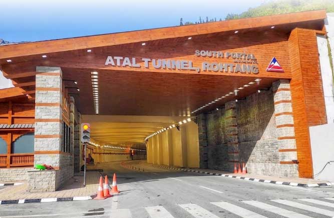
South Portal: Manali side (Dhundi), North Portal: Sissu.
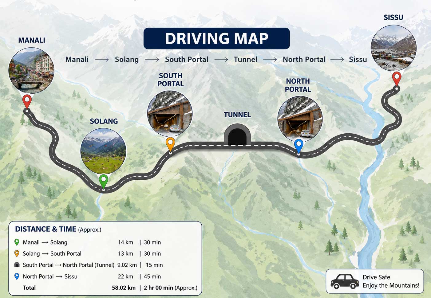
Driving map: Manali → Solang → South Portal → Tunnel → North Portal → Sissu.
Manali – Solang – South Portal (28 km). Road is paved but steep.
Most popular among bikers. Fuel at Manali, Solang, Sissu.
Local taxis from Manali, Kullu, Bhuntar available.
HRTC buses from Delhi, Chandigarh, Shimla to Manali, then local bus.
Adventurous route, but check road conditions.
Carry chains, warm clothes, and check BRO updates.
| Destination | Distance (km) | Travel Time (approx) |
|---|---|---|
| Delhi | 540 | 10-12 hrs |
| Chandigarh | 310 | 6-7 hrs |
| Shimla | 220 | 5 hrs |
| Kullu | 55 | 1.5 hrs |
| Kasol | 68 | 2 hrs |
| Bhuntar | 50 | 1.2 hrs |
| Naggar | 35 | 1 hr |
| Solang | 15 | 30 min |
| Sissu | 12 | 25 min |
| Keylong | 62 | 1.5 hrs |
| Jispa | 70 | 1.8 hrs |
| Leh | 380 | 8-9 hrs |
| Month | Weather | Snow | Recommend |
|---|---|---|---|
| Jan | -10°C | Heavy | ❄️ Only with chains |
| Feb | -8°C | Heavy | ❄️ |
| Mar | -2°C | Moderate | ✅ |
| Apr | 5°C | Light | ✅ |
| May | 10°C | Nil | ⭐⭐⭐ |
| Jun | 15°C | Nil | ⭐⭐⭐ |
| Jul | 12°C | Nil | ⭐⭐⭐ (monsoon) |
| Aug | 10°C | Nil | ⭐⭐ |
| Sep | 8°C | Nil | ⭐⭐⭐ |
| Oct | 2°C | Light | ⭐⭐⭐ |
| Nov | -4°C | Moderate | ✅ |
| Dec | -8°C | Heavy | ❄️ |
Current: -2°C, Snowfall, Wind 20 km/h.
Monsoon: landslides, check BRO.
Fog common in winter.
OPEN – BRO clearance. Snowfall updates: light.
Traffic: Moderate (peak hours 10-2).
Toll tax: FREE for all vehicles.
Emergency: SOS phones, ambulance, police.
Oxygen levels low. Senior citizens, pregnant women, heart patients consult doctor.
Stopping, parking, smoking, drone, cycling, honking, reverse driving.
SOS phones, ventilation, fire safety, CCTV, ambulance, recovery vehicles.
Longest highway tunnel above 10,000 ft.
All-weather access to border areas.
Round-the-year tourism to Spiti Valley.
Photography allowed at portals only. Best viewpoints: South Portal, North Portal, Sissu bridge, Dhundi.
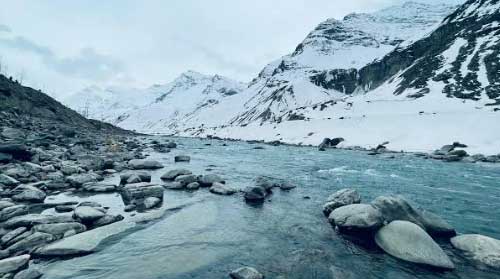
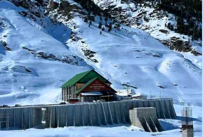
Solang Valley, Sissu, Keylong, Rohtang Pass, Nehru Kund, Gulaba, Koksar, Jispa, Baralacha La.
North Portal dhabas, South Portal cafes, Sissu restaurants.
Paid parking at portals, free at Sissu. Bus/bike parking available.
Before and after tunnel, at petrol pumps, restaurants.
Nearest: Manali (28 km), Solang (15 km), Sissu (12 km). Diesel available.
Available at Manali, Solang, Sissu (Type 2, CCS).
Jio, Airtel, Vi, BSNL. Inside tunnel: limited connectivity.
South portal: Solang resorts. North portal: Sissu homestays. Keylong hotels.
Legal camping at Sissu, Solang (glamping available).
Snow scooters, skiing, tube rides at Solang.
Winter: carry chains, emergency kit. Monsoon: landslides, check BRO.
Kid-friendly stops, wheelchair access at portals, sunrise/sunset viewpoints.
Fuel, repair shops at Manali, Sissu. Gear checklist: helmet, gloves, warmers.
Road condition, parking, navigation, driving etiquette.